
With smappen, you can draw isodistances for your catchment areas easily and free of charge. These areas show everything within a certain distance of a given point. They are often used for market-analysis purposes, or for having a look at a delivery area.
How to Create a Distance Area #
- Click “Create a new area.”
- Set a starting point by entering an address, city, or GPS coordinates, or by right-clicking on the map and selecting “Starting address.”
- Choose the area type “Distance,” select a travel mode (e.g. Driving).
- Define the distance using the purple slider or by entering a value manually.
- Click “Calculate.” The distance area is created automatically.
FAQ #
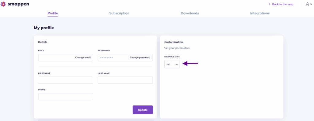
🟢 How can I change the distance unit (km/mi)? #
To switch the distance unit from kilometers to miles (or miles to kilometers), go to the “Customization” section in “My Profile.”
🟢 Can I draw circular delivery areas? #
Yes. If you offer deliveries, you can easily create a circular delivery area.
When creating a new area, simply select “Circle” in the travel mode section to define a fixed-radius delivery area
To go further: