

Mapping Software
For Territories, Sales & Franchise Planning
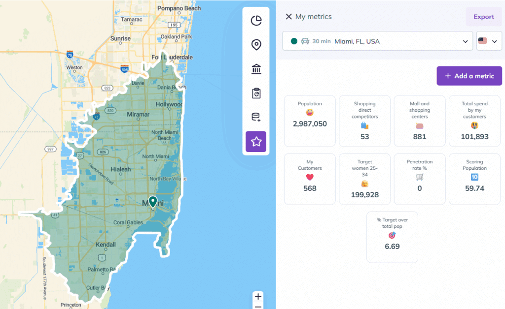
Smappen is territory mapping software that lets you draw, analyze, and share geographic areas (sales regions, franchise territories, service zones, …) without GIS expertise. You build a territory, pull in demographic and business data, and get a shareable map and report in minutes, not days.
Key takeaways
- Mapping software turns geographic and demographic data into interactive maps you can use to plan territories, target markets, and guide location decisions.
- The best tool for your team is the one that matches your real job — territory management, market research, site selection — not the one with the longest feature list.
- The global GIS software market was valued at roughly $11.6 billion in 2025 and is forecast to grow at a ~14.6% CAGR through 2035 (Global Market Insights, 2025), as more teams move mapping from spreadsheets to dedicated software.
- Smappen is built for territory, sales, and franchise mapping: draw an area, get census-grade demographics and points of interest automatically, and export a Word/Excel report — no GIS background needed.
What is mapping software?
Mapping software is a digital tool for creating, editing, and analyzing maps by combining different data sources into one visual view. It turns raw geographic data into clear insights (boundaries, spatial relationships, and trends) on interactive maps. Many mapping tools build on Geographic Information Systems (GIS) for deeper spatial analysis and precise geodata management.
Any organization that manages territories, plans routes, or needs to understand a region uses mapping software to make those decisions visual and fast.
What is mapping software used for?
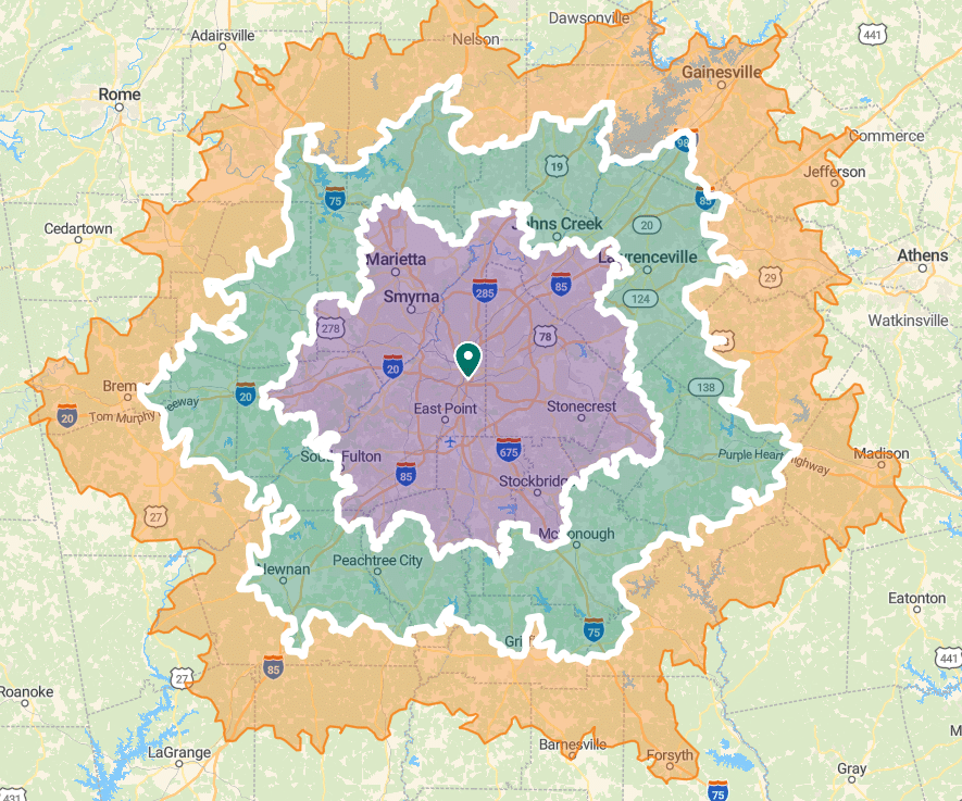
- Sales territory management: Align sales regions with precision, balance workloads across reps, and stop the overlap that causes rep conflict.
- Franchise territory planning: Define, map, and protect franchise territories so you can grow the network without cannibalizing existing franchisees.
- Geomarketing & market research: Find where your best-fit customers are before you open, using demographic and business data.
- Retail & site selection: Compare locations on population, income, and competitor presence to pick the site that performs.
- Logistics & service areas : Map coverage zones and find efficient routes for field teams and deliveries.
What features does mapping software offer?
Most mapping software includes some mix of these features:
- Interactive map creation: build and adjust maps with drag-and-drop tools.
- Data integration: import data in formats like CSV, KML, GeoJSON, and MapInfo to build complete spatial datasets.
- Customizable visualizations; set colors, symbols, and labels to highlight the data points that matter.
- GIS analysis: run spatial measurements, area calculations, and demographic analysis.
- Geocoding: turn postal addresses into GPS coordinates.
- Heatmaps: visualize data intensity across a map.
- Demographic and business data: pull population, income, and points-of-interest data straight from official sources.
- Reports and charts: summarize data in tables and charts, and export to Word or Excel.
- Collaboration: share maps and work with your team in real time.
Benefits of Mapping Software
- Faster decisions: visual territory data lets stakeholders decide quickly, with the numbers right in front of them.
- One source of data: pull demographics, business locations, and your own CRM data into a single map instead of five spreadsheets.
- Less manual work: automated area calculations and reports replace hours of hand-drawing in Google Maps.
- Grows with your network: add territories and data as you expand, without rebuilding from scratch.
- Better teamwork: share live maps so everyone works from the same picture.
- Lower costs: automating analysis and planning cuts the time and expense of doing it by hand.
Which type of mapping software fits your job?
| If your goal is… | What to look for | Smappen fit |
|---|---|---|
| Manage sales or franchise territories | Territory drawing, overlap detection, demographics per area | ✅ Built for this |
| Market research and geomarketing | Census data, points of interest, heatmaps | ✅ Included |
| Site selection / retail expansion | Drive-time areas, competitor mapping, data import | ✅ Included |
| Heavy custom GIS / developer work | Scripting, spatial SQL, cloud warehouse | ⚠️ Use a full GIS (Esri, CARTO) |
| Turn-by-turn navigation | Live routing, traffic | ❌ Not a navigation app |
How to choose mapping software
Start with the job, not the feature list. The best mapping software is the one that matches how you’ll actually use it. Work through five questions:
- What’s the core job? Territory management, market research, route planning, or pure GIS analysis? Each points to a different tool.
- Who’s using it? If non-technical team members need it, prioritize ease of use over raw GIS power.
- What data do you need built in? Demographics, business and points-of-interest data, and drive-time areas save you from sourcing data separately.
- Can it import your data? Check for CSV, KML, GeoJSON, and CRM integrations.
- How do you share results? Look for live map sharing and Word/Excel report export, so insights leave your screen.
Match those answers to a tool and you’ll skip months of trial and error.
What is the best mapping software?
The best mapping software combines precision, ease of use, and the right built-in data for your job. Smappen stands out for territory mapping: an intuitive interface, GIS capabilities, census-grade demographics, and real-time data, built for professionals who need accurate, shareable maps without a GIS background. With Smappen, you get a tool that simplifies territory planning today and grows with your business.

Heat Mapping Capabilities
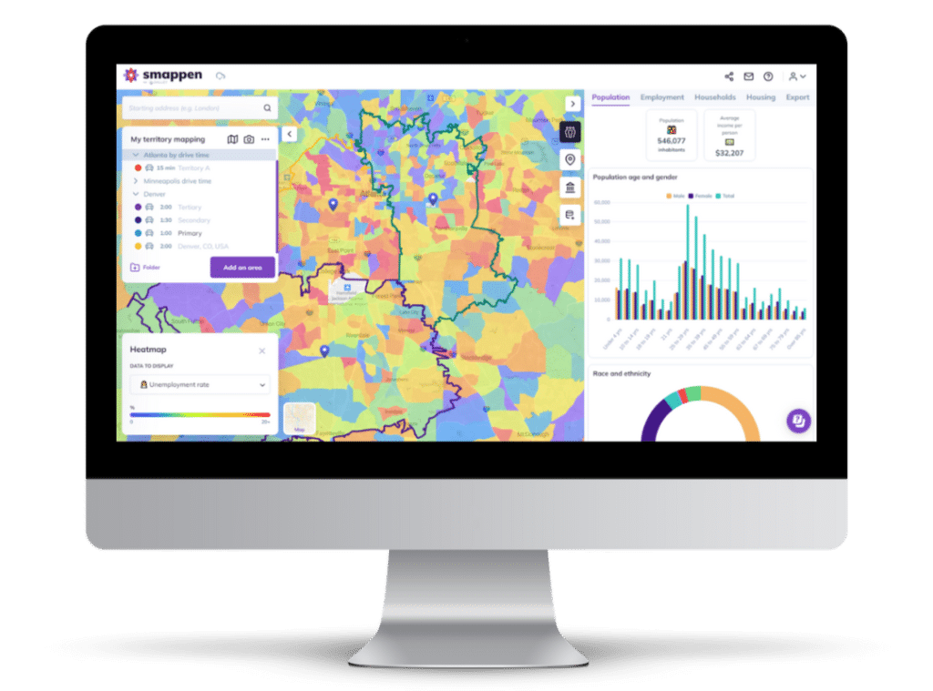
Smappen’s heat mapping brings density to life. Color gradients highlight hotspots (high customer concentration, sales activity, or where to allocate resources,…) so you can spot the areas that need attention at a glance, and act on them.

Manage your territories

Create and manage your sales or franchise territories, analyze your areas with demographic data, and map your customers, or import your own data.
Access demographic and POI data

Smappen gives you the exact indicators for each of your areas, straight from the census database. Start analyzing your areas to find the best location.
Get automated data report

Generate branded, shareable reports directly from your maps: showing market potential in a format your prospects can act on immediately.








Testimonials
Trusted by franchise developers
The world’s simplest and most intuitive mapping app
Between its built-in data and its ability to work with any data you add, Smappen is built for business intelligence, strategy, and logistics. Manage your coverage areas, run market research, look up demographic data, and get what you need to make the best decisions for your customers.

FAQs - Mapping Software
What is mapping software?
Mapping software is a digital platform that combines geospatial data from multiple sources to create, edit, and analyze interactive maps. It uses GIS capabilities to turn raw data into visual insights for territory planning and decision-making.
How can mapping software improve business operations?
By turning geographic data into clear maps, mapping software speeds up decisions, replaces manual spreadsheet work, and helps teams allocate resources and spot market opportunities. Territory, sales, and franchise teams use it to plan coverage and reduce overlap.
What is heat mapping and how does it works?
Heat mapping is a feature that uses color gradients to visually represent data density and intensity across a map. It helps identify hotspots—areas with high concentrations of activity or data points—making it easier to pinpoint regions that require strategic focus or further analysis.
What should I consider when choosing mapping software?
Key factors include ease of use, the ability to integrate diverse data sources, robust GIS and customization features, real-time updating capabilities, scalability to grow with your business, collaborative functionality, and strong customer support. These elements ensure the software meets your operational needs and delivers actionable insights.
What is the best mapping software?
When evaluating mapping software, the best solution is one that combines precision, ease of use, and robust functionality tailored to your organization’s unique needs. Smappen distinguishes itself as the leading choice for territory mapping by offering an intuitive interface, comprehensive GIS capabilities, and real-time data integration—all backed by a focus on simplicity and collaborative efficiency.
Read our best articles on mapping software
Mapping Software: Transforming Data into Visual Insights
Embark on a journey into the realm of mapping software. Uncover how businesses leverage the fusion of data and geography
GeoMapper Alternative for HubSpot Users in 2025 – CRM Mapping with Smappen
Looking for a GeoMapper alternative? Learn what happened to GeoMapper and discover a powerful HubSpot-ready solution for mapping.
Smappen: The Smarter Territory Mapping Software
Discover how Smappen’s intuitive territory mapping software helps businesses and franchisors optimize coverage, reduce overlap, and growth.
Best Franchise Software in Canada: Compare the Top Tools (2025)
Discover the best franchise software in Canada for 2025. Compare top tools to manage territories, grow networks, and expand faster.
Franchise Expansion (2025): How Territory Mapping Software Can Accelerate Your Growth
Discover how franchise territory mapping software helps franchisors grow smarter in 2025. Accelerate franchise growth with Smappen!
Boost Your CRM with Mapping: Unlock Growth Through Smart Territory Tools
Imagine seeing your contacts, prospects, and clients splayed across a map… That’s exactly what Smappen delivers with HubSpot integration!
5 Key Benefits of Using a Mapping Tool with HubSpot Integration
Learn how Smappen’s HubSpot integration transforms your sales strategy: automated CRM sync, map-based lead targeting, smarter routes, and territory performance insights.
Start using Smappen now