There was a time when maps were incredibly rare. Each one was carefully crafted by a skilled cartographer and greatly treasured by whoever owned it. Nowadays? Not only can you pull up a map of any place on Earth with your phone, you can even use a map maker to customize it or use it to visualize your research.
But how do map makers work, exactly? And which one should you be using?
What is a map maker?
A map maker is a software platform that gives users the ability to draw on, manipulate, and layer data on top of an existing map. The simplest examples of these tools have limited features, allowing you to draw areas, map out a travel route, and maybe even use publicly-available data to create maps you can use in an educational setting.
More complex solutions let you import your own data, build isochrone or isodistance maps, and create custom exports for all sorts of business needs.
What is Google Map Maker?
Google Map Maker is a now-defunct service that allowed enthusiasts to get together and help map out the world through Google Maps — meaning a lot of the data you use every day comes from this service. Whether it was correcting the name of a street or adding a business that just opened, the Google Map Maker community helped make Google Maps what it is today.
A similar platform, Google My Maps, allows users to create their own maps using Google Maps data.
How to make a custom map with Google My Maps
Map makers use a layer-based system, meaning that a user can add layers of information on top of an existing map. Google’s My Maps is one of the most common examples, and it’s incredibly easy to use. Here’s how it works.
First, go to Google My Maps. If you’ve never used this platform before, you’ll see this screen.
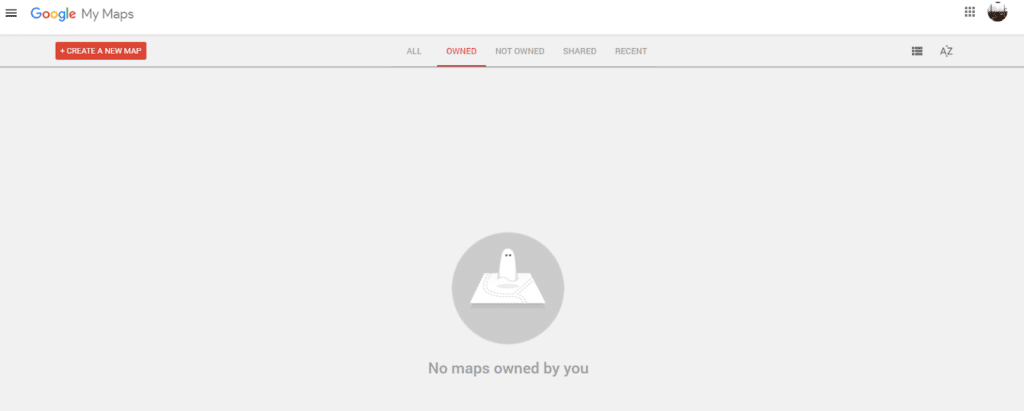
Hit the red +Create a New Map button.
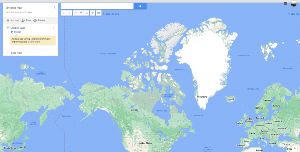
See that search bar at the top of the screen? Enter the location you want to start with. Like, say, the Empire State Building.
Now that you have a location, let’s go over the tools in that bar near the top.
- With the arrows, you can undo and redo your last actions, respectively.
- The hand lets you move the map around and select locations by clicking on pins and other points of interest.
- The pin allows you to add your own markers to the map. You could use this to mark, say, a contact’s address or a pick-up point.
- The line lets you do a few things. You can draw a simple line, create a shape, or add a travel route that automatically snaps to roads and highways.
- With the directions tool, you can add a layer of driving directions to your map.
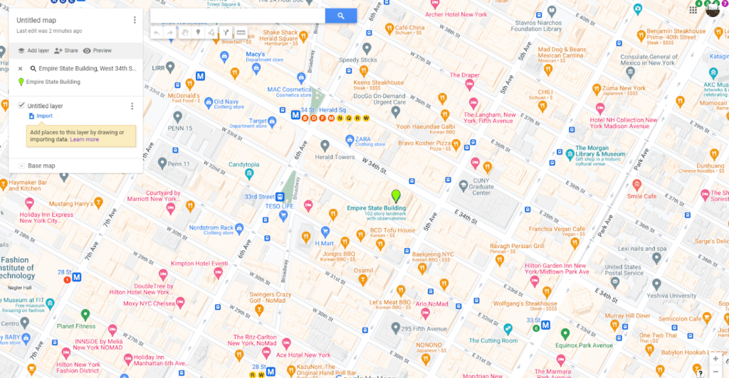
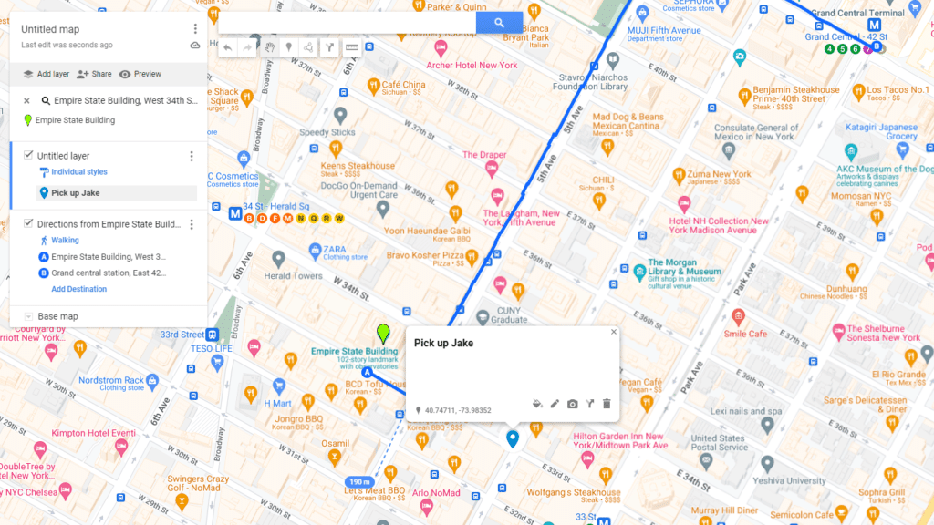
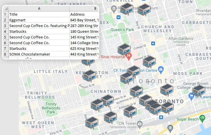
With these tools, you can create maps with a ton of information on them. Say, for instance, that you’re planning to visit the Empire State Building. You want to get directions that will take you from Grand Central Station to the building, include a pin for picking up a friend at the corner of East 35th Street and Madison Avenue, and know the distance between the Empire State Building and the Korean restaurant you’ll be going to later. Here’s what that map would look like.
This is just one example of what you can do with the right map maker. So how do you make sure you’re picking the right platform?
5 examples of map maker tools
Google My Maps
Google My Maps is a completely free platform that has access to all the data you’d expect to find in Google Maps. That means you’ll find points of interest, driving directions, and more. Don’t expect to build isochrone or isodistance maps with this one, though.
Smappen
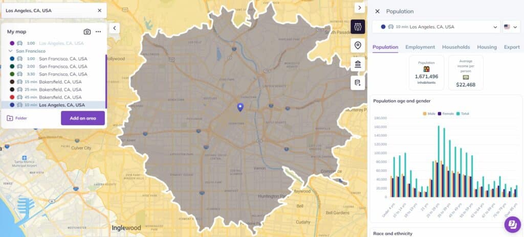
Smappen is a location intelligence platform that lets you do pretty much everything you’d expect from a map maker, but it also gives you access to dedicated data tools for improving your business strategy, planning marketing campaigns, and optimizing logistics. You can create radius maps, isochrone maps, coverage areas, and more with a few clicks. You’ll also be able to use a range of data, from Google Maps data to U.S. census data, and you can import your own, too.
Best of all? You can use Smappen for free.
National Geographic MapMaker
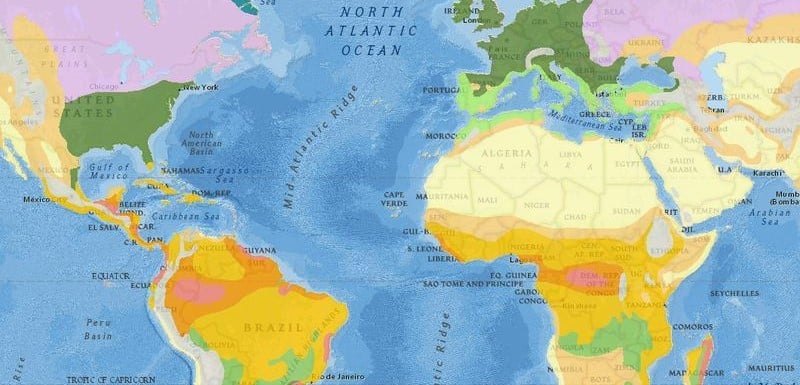
For users with more particular needs, National Geographic’s MapMaker might be the best map maker in this list. Where other platforms use Google Maps data to let you draw coverage areas or get driving directions, this one will give you all sorts of data, from coral bleaching to drought indexes and recorded earthquakes. This makes it a great tool for educators and academics.
MapChart
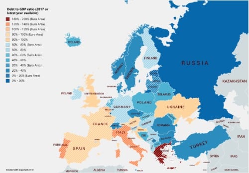
MapChart works a little differently than other map makers in this list. Instead of drawing lines and placing pins at street level, this tool is all about communicating data at the state and country scale. Just pick a map — like Europe — and start clicking on territories to paint them a specific color. This lets you create simple maps for punching up your presentations, visualizing your research, or communicating your business strategy.
Scribble Maps
Despite its innocuous name, Scribble Maps is a deceptively powerful platform. With a wide range of uses across business strategy, marketing, logistics, and more, you can use this tool to draw lines, turn a spreadsheet into a map, optimize routes, and create isochrone maps — and that’s just scratching the surface.
How to make a map using Smappen
Using Smappen to draw coverage areas and other kinds of maps is dead simple, but did you can also import your own data? Here’s how.
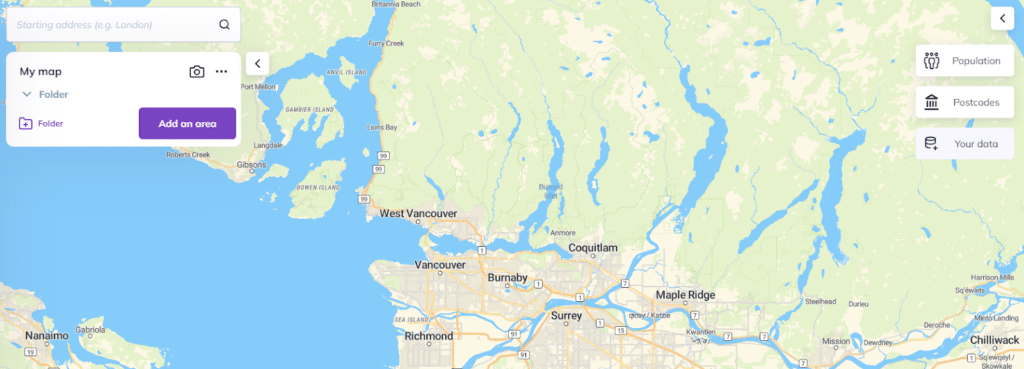
Start by opening Smappen.
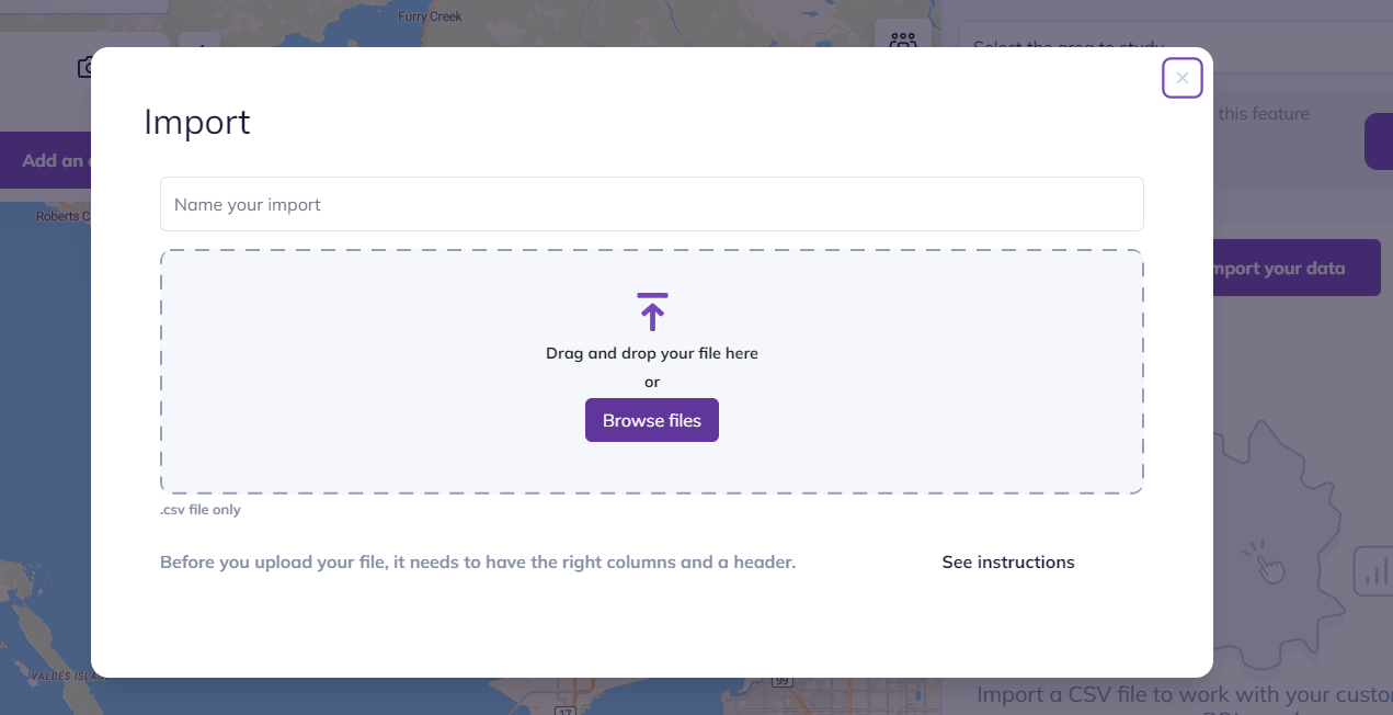
Next, hit the Your Data button on the right side of the screen.
Then, hit Import your data and drag your file into the Import screen.
Finally, you’ll be asked to choose the column in your file that has the addresses you want to work with.
And just like that, you can work with your data within one of the most robust map makers around!
Want to try it out? Go create your first map with Smappen here.
Make that map
A map maker can be really useful in your personal life, but it also has its place as a business tool. Whether you’re just trying to get great graphics for a presentation or your maps are a key part of your business strategy, having the right tool for the job can make your workflow a whole lot smoother.