

Radius Map
Create Free Radius on a Map with Smappen
Create a radius map by distance or drive time in a few clicks. Then go beyond the circle: see the population, competitors, and real market potential inside your radius. No GIS skills required.
What is a Radius Map?
A radius map is a circular area drawn around a central point — an address, a city, or a store — based on a set distance, such as 5, 10, or 30 miles. Businesses use radius maps to visualize coverage zones, understand how far customers are located, and analyze the market around a location.
Concretely, a radius map helps you answer three questions:
- How far are my customers or prospects from a given location?
- What’s my reach — which neighborhoods, zip codes, or cities fall inside my coverage zone?
- What’s around — competitors, points of interest, market opportunities?
It’s usually the first step in any geographic analysis: simple, fast, and easy to read.
How to Create a Radius Map in Less Than a Minute
With Smappen, creating a radius map has never been so easy!
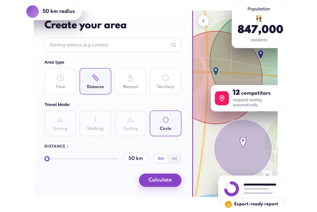
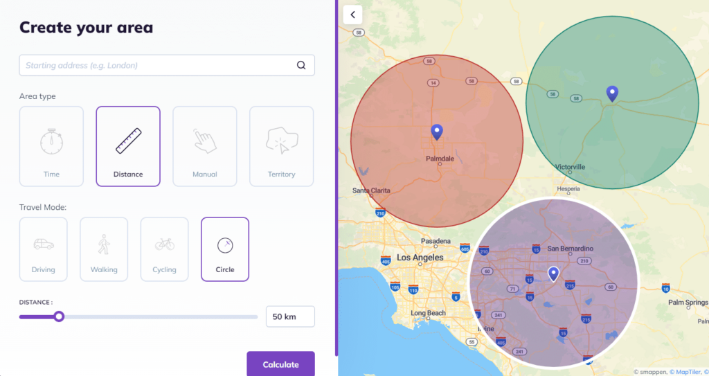
- Go to smappen.com/app — it’s free
- Click “Add an area”
- Enter your starting point address
- Select the “Distance” travel mode
- Click “Circle” mode
- Set the distance you need, in miles or kilometers
- Click “Calculate”
That’s it. Your radius is on the map, and you can already explore what’s inside it.
With Smappen, the circle is just one option: you can also draw areas by drive time, by road distance (isodistance), or by states, counties, and Zip Codes (or Postcodes).
Just need a quick circle on a map?
Use our free radius map tool — draw a radius around any address, no signup required.
Why Businesses Use Radius Maps
Radius maps aren’t just circles on a map. They’re how teams make smarter local decisions.
Franchise development
Franchisors use radius maps to define exclusive territories, avoid overlap between franchisees, and validate expansion zones before selling a territory. A simple radius often answers the key question: “Is there enough room for another location here?”
Example: a fitness franchisor draws a 15-mile radius around a candidate site to check whether the new territory would impact nearby franchisees — before the first conversation with a franchise candidate.
Sales territories
Sales teams use radius maps to assign leads within a defined distance, balance territories between reps, and cut drive time. Instead of guessing, everyone sees who covers what and why.
Example: a B2B sales team maps a 30-mile radius around each rep. The result: clearer territories, fairer workload, less time on the road.
Retail and site selection
Retailers use radius maps to visualize the area around a store, compare potential locations, and analyze competitors and customer distribution. It’s the fastest way to understand real local reach before committing to a lease.
Local marketing
Marketing teams use radius maps to focus campaigns where their ideal customers live, prioritize high-potential areas, and align local marketing with sales or franchise territories.
Radius Map vs. Drive-Time Map: What's the Difference?
Radius maps and drive-time maps are often confused, but they serve different purposes.
| Radius map | Drive-time map |
|---|---|
| Based on straight-line distance | Based on real travel time |
| Very fast to create | More precise in urban areas |
| Great for a first analysis | Ideal for operational planning |
| Simple and easy to read | Accounts for traffic and roads |
In practice, many teams start with a radius map, then refine their analysis with drive-time maps. With Smappen, you can do both in the same map.
What's the Best Radius Map Tool?
Here are some of the best radius map tools:
- Smappen is highly regarded as an overall tool.
- Maptive, more difficult to use.
- CalcMaps is a good basic, but limited when it comes to business data, territories or real-world use cases.
- Free Map Tools is also useful for quick, one-off visualizations. But not built for teams.
- TravelTime is excellent for advanced use cases, but more technical, less intuitive.
Here’s a comparison of different tools for creating and analyzing radius maps.
Each of these offers different functionalities, catering to various needs from basic mapping to advanced data integration and analysis. Your choice will depend on the specific requirements of the task at hand and radius calculator needs to be free or can be a paid service.
Go Beyond the Circle: Analyze What's Inside Your Radius
Drawing the radius takes a minute. The value is in what you do next.
Demographics inside your radius
Access population data within your radius: age, gender, income, housing, and more. You’ll know in seconds whether an area has enough of the right customers to support your business — no data science required.
Competitors and points of interest
Search any keyword to map businesses inside your radius: competitors, complementary services, anchor stores. You get a clear picture of the local market dynamics before making a move.

Your own data on the map
Import your customer file and see exactly where your revenue comes from.
Answer questions like “Where do my customers come from?” and “Which zone generates the most revenue?” — then build territories around the answer.
And when you’re done, export a clean, professional report you can share with your team, a franchise candidate, or a landlord.
Smappen works on a monthly subscription with no long-term commitment and fair pricing — you pay for the stage you’re in, not the one you’ll reach in five years.
Smappen helps you better understand your territories. You can evaluate driving distances, analyze a market, or establish your service area.
Justin Bowen, The Great American Home Store
There's so much data that you can pull from when you draw the maps. And you can export everything for reporting.
Angie Honeycutt, VP at 1 Tom Plumber
Why Choose Smappen for Your Radius Mapping Needs
What sets Smappen apart from its competitors? Our user-friendly approach, coupled with a highly responsive support team, ensures you get the most out of our geomarketing solution. Unlike others, we offer flexible pricing with a monthly subscription model and no long-term commitment, making Smappen accessible to businesses of all sizes. With minimal training requirements, you’ll be up and running in no time.
Position your business at the forefront of local market research with Smappen – your trusted partner in geomarketing!
Read our best articles on radius map
Isochrone VS Radius map – Usage and Interest for Your Business
Leverage isochrone maps and radius to drive strategic decisions, improve market analysis, and optimize customer accessibility.
The 5 Best Tools for Drawing Radius Maps
Discover what radius maps are, how they’re used, and why tools like Smappen offer the most dynamic way to harness their potential.
How to use radius maps for delivery
Create dynamic radius maps easily with tools like Smappen, enhancing delivery strategies and business planning.
Zip Code Radius: A Comprehensive Guide for Businesses
Find all ZIP codes within a specific radius using a Zip Code Radius Tool like Smappen, ideal for targeting better business locations in the US.
How a Map Radius Calculator can Transform your Business
Discover what radius maps are, how they’re used, and why tools like Smappen offer the most dynamic way to harness their potential.
All you need to know about radius maps
Discover what radius maps are, how they’re used, and why tools like Smappen offer the most dynamic way to harness their potential.
FAQ - Radius Map
Can I draw a radius around my current location?
Can I get the list of ZIP codes inside my radius?
Yes. Once your radius is drawn, Smappen lists every ZIP code inside it, ready to export or plug into your CRM, ad platform, or mailing list.
How big is a 5-mile radius?
A 5-mile radius covers roughly 78 square miles, a 10-mile radius about 314. The exact reach depends on the terrain and road network around your point, which is why a map view matters more than the math.
How many people live within a 10-mile radius of my location?
Draw your radius and Smappen shows the population inside it instantly, broken down by age, income, and household data, no separate census lookup needed.
Can I draw a radius in miles or kilometers?
Yes. With Smappen, you can set your radius in miles or kilometers, and choose between a straight-line circle (as the crow flies) or a road-based isodistance area.
Create Your Radius Map with Smappen