Location, location, location. It’s not just important for real estate; it’s a huge part of running a business, even an online-only one. You need to know everything about your business’ location, including how long a potential customer might have to drive to reach you, how far your delivery drivers should go, and more. The best way to do this? A radius map tool.
Let’s cover how these softwares work and five of the best options out there.
What is a radius map?
A radius map is a circular area drawn on a conventional map, usually using travel times or distance as a unit of measurement. That area will be centered on the specific address — or even GPS coordinates — of a private home, a business, or an institution. It can be used to find services within a specific driving range (like hospitals and schools), to visualize a delivery radius, or even to optimize business logistics.
What do you need from a radius map tool?
A Radius Map Tool generates a visual circle—often called a “radius” or “buffer”—around a selected point. This circle represents a fixed distance (or travel time) from that point, giving you a clear view of the area accessible within that boundary. It’s an indispensable resource for:
- Business Location Analysis: Identify where potential customers live or work.
- Marketing Campaigns: Target advertisements based on geographic reach.
- Personal Planning: Discover neighborhoods or amenities within a convenient distance.
When choosing a mapping tool, here are some features you should be looking for.
The ideal radius tool should allow you to create a map in just a click or two. You should look elsewhere if it’s any more complicated than that.
A point of interest is any site that someone will find interesting, from restaurants to hotels and warehouses. A radius tool should allow you to cross-reference this location data.
Whenever you have data represented geographically, you’re working with location intelligence. That can include demographic data, infrastructure data, or personal data, all of which can be incredibly useful when combined with a radius map.
Now that you know what you need, let’s have a look at your options.
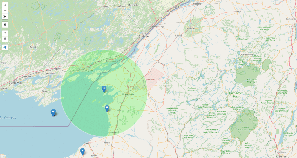
Smappen: Best overall radius map tool
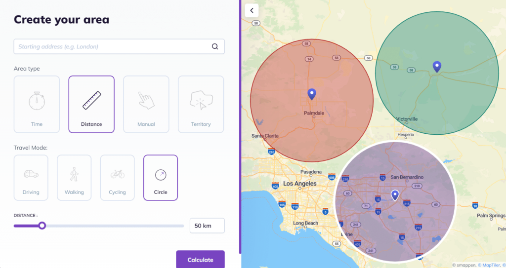
Smappen is a radius mapping tool that can also do a whole lot more. You can draw out multiple radius circle map in just a few clicks, overlay them, and cross-reference them with a ton of data for market research, logistics optimization, and more.
That’s because Smappen comes fully loaded with points of interest, demographic data, and even competitive insights. That makes it a natural pic for marketers, franchisers, retailers, and anyone else who needs to create a radius map for this kind of research!
Radius map tool – Uncover your ideal catchment area with Smappen
At Smappen, we believe that knowing your reach is key to making smart decisions. Our radius map tool lets you effortlessly visualize the catchment area around any location. Whether you’re a business owner scouting the best spot for a new outlet or an individual curious about nearby amenities, our tool offers an intuitive way to see exactly which areas fall within a specific travel distance. Backed by years of on‑the‑ground experience and advanced GIS data, our tool ensures that every map you create is both reliable and easy to understand.
Biggest drawback
Some have a bit more data to work with than Smappen, which might suit your needs better. But these softwares are usually a bit harder to wrangle, meaning you’ll need more technical skills to make them behave.
Maptive
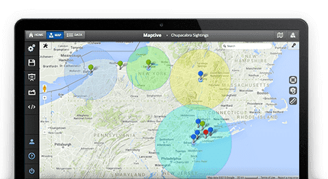
Maptive is an example of enterprise-level GIS mapping software you can use to create a radius map. You can also use it to optimize routes, create heatmaps, and add up to 100,000 sites to the same map.
This might be one of the most customizable radius calculator you’ll find out there, allowing you to color-code individual pins, use branded images in your maps, personalize your base map, and more.
Biggest drawback
Unlike most of the radius calculators on this list, Maptive doesn’t have a free plan. It does offer a free trial, which will let you test it out for 10 days. After that, you’ll have to pay at least $110 a month to keep using it — unless you get the 45-day pass for $250.
CalcMaps
CalcMaps is a completely free suite of online mapping tools that can help you calculate areas, distances, and elevation, as well as draw circle radius. Drawing these maps is dead simple. All you need to do is open the radius calculator, pick an address, pick a distance, and you’ll instantly have a radius map. You’ll also know the area of the circle you’ve just drawn, which can be useful for some types of research.
Biggest drawback : missing location intelligence
The different softwares you’ll find at CalcMaps don’t really interact with each other, meaning you couldn’t draw a radius map and measure distances between two points on the same map, for example. But more limiting than this is probably the fact that this radius calculator doesn’t have any of the data you’ll get from other solutions. No POI data, no demographic information, no location data, nothing. So while it’s a simple, free way to draw a radius map, you won’t be able to do any deep research with it.
Free Map Tools
Free Map Tools is another website that comes loaded with a number of free softwares that let you calculate distances and draw radius maps. To use this software, you just need to open it, put a pin on the map, and drag out your circle. You’ll know the exact radius circle map, and even get an option to export that area — with coordinates — to import into whatever other software you’re using.
Biggest drawback
While it shares some of the limitations of other free options on this list — like not having any POI or demographic and location data — the most frustrating one is trying to create a radius map to start in exactly the right place. Others usually let you start from an address, but this one doesn’t. You can certainly put in coordinates, use your current site adress, or even the name of a city, but you can’t manually enter an address. That can be pretty limiting.
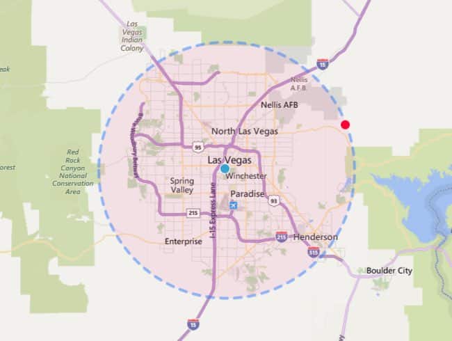
TravelTime
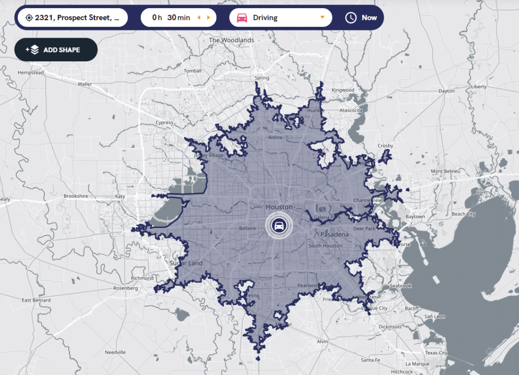
There’s one thing that sets TravelTime apart from most of the devices on this list. Where they only let you draw simple radius maps (measuring distance without accounting for terrain) the maps you create with TravelTime are isochrone (showing you how far you can travel in a specific amount of time). These maps are particularly useful for figuring out delivery ranges, identifying coverage areas, and even picking a new site for a franchise. You can even layer multiple maps to compare locations.
Biggest drawback
TravelTime might allow you to draw a more detailed map with more data, it’s really all you can do with it. You can’t even switch from isochrone maps back to simple radius maps. That means TravelTime can be a solid free option for very specific tasks, but it’s far from being the all-in-one radius tool you need. Compare this with Smappen, which can draw simple radius maps, isochrone maps, isodistance maps, and more!
In your radius
Radius maps are incredibly useful for marketing research, logistics optimization, and business strategy, so most businesses will benefit from having a tool that can let anyone draw them quickly. But, as you’ve seen, not all softwares are created equal. It’s best to have one that strikes the right balance between being easy to use and fully featured, allowing you to draw all kinds of maps, compare them, and combine them with data.
If that’s what you want, you should try Smappen! You can get started for free and see how radius maps can completely transform your strategy.
Frequently Asked Questions (FAQ)
A radius map tool creates a circle around a specific location, showing all areas within a predetermined distance or travel time. This helps businesses and individuals easily visualize their catchment area.
The best radius map tool will vary based on your goals. For users seeking a powerful tool that offers clear, customizable radius maps with real-time data, Smappen free radius map tool is a great option. Our software not only generate accurate, visual catchment areas but also provides advanced GIS features, demographic insights, and flexible distance or travel time parameters. If you’re looking for a more general tool, other options like Google Maps can help with basic radius mapping but might lack the in-depth business insights that Smappen offers. Ultimately, the best tool is one that fits your specific use case, whether it’s for personal planning, business location analysis,…
Simply enter your starting location, set your desired distance or travel time, and click “Calculate” to generate your map. It’s that easy!
Absolutely. By understanding the geographic reach of your customer base, you can make informed decisions on where to locate new stores, plan efficient delivery routes, and target marketing campaigns more precisely.