Reliable location data for smarter territory planning
Map, validate, and scale territories with trusted up-to-date data.
Demographic data you can rely on
Smappen provides demographic data designed for confident territory decisions. Curated datasets are automatically updated and applied directly to each territory, so your analysis always reflects the latest population and market realities.
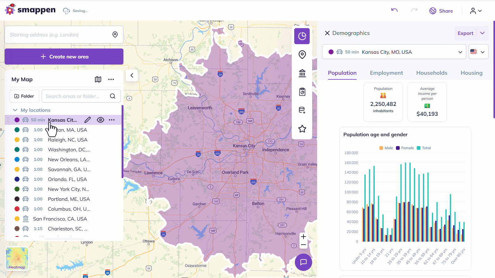
Population
By age, gender and more.
Household
By age, gender and more.
Income
By average and medians, household and more.
Labor Force
By employment status, industry, occupation and more.
Commuting & Mobility
By mode of transport to work, travel time between home and workplace, work-from-home indicators.
Housing and Dwellings
By dwelling type, year built, occupancy status, housing value or rent, vehicle ownership.
Ethnicity & Origin
By ethnic origin, race or ancestry indicators.
Education
By highest level attained, enrollment status, age group.
👉 View our detailed data coverage and definition in the Help Center.

Identify coverage gaps and competition
Smappen shows the businesses and services operating inside each territory through detailed Points of Interest (POI) data. Explore POIs directly on the map to identify competitors, amplifiers, and areas with limited or no coverage. This makes it easy to spot underserved zones and prioritize expansion areas. Business lists can be downloaded for outreach and activation.
Get more from your data with My Metrics
No two networks evaluate territories the same way. My Metrics lets you combine your internal data with demographic and POI data to create custom indicators that help you assess territory potential. Calculate metrics such as consumer expenditure potential, penetration rates, or location-based ratios to assess and compare territories faster. Visualize these indicators as heatmaps to surface outliers and high-potential areas.


Map your internal data directly on your territories
Smappen lets you map your prospects, clients, and internal data directly onto your territories. By connecting your CRM or importing your own datasets, every lead, account, or location becomes part of your map. With native HubSpot integration and flexible data imports, your map reflects your territories as they actually operate.
Need something specific?
Smappen is built around a carefully curated set of datasets that support the majority of territory planning use cases and we’re always open to adding more.
Have a specific use case in mind? Let’s chat.
Explore Smappen for free
Explore demographic insights, understand your local market, and structure decisions with data you can trust.