Ever wonder how businesses figure out the best spot for their next store or how city planners decide where to build new parks?
Well, that’s where Location Intelligence comes into play. It’s like having a superpower that lets you dive into maps and data to uncover hidden patterns and secrets. And Location Intelligence Software can be a great ally in this quest.
Let’s dive into the go-to Location Intelligence tools to unlock your business and how to choose the right one for you.
What is Location Intelligence Software?
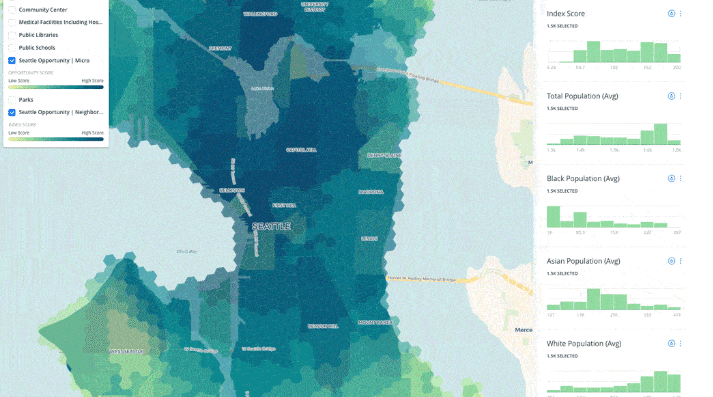
But first, some definition 😉 Location Intelligence Software refers to a range of tools and platforms that enable you to collect, analyze, and visualize geographic and spatial data. This technology takes all sorts of data from GPS, satellite imagery, and transforms them into actionable insights.
It finds extensive applications in urban planning, marketing, sales, logistics, environmental monitoring, and more. By leveraging location intelligence, businesses and organizations can beat typical location intelligence challenges like an initial lack of data, outdated data, or inadequate visualizations. The final goal? Make informed decisions, optimize operations, and understand complex spatial relationships.
The Best Tools for Location Intelligence
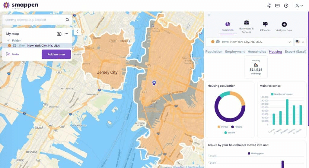
Smappen
Smappen is designed for modern brands who want an innovative, user-friendly mapping solution that seamlessly integrate insightful spatial data and visualization.
Key Features:
- Intuitive and easy-to-use interface.
- Interactive map creation and sharing.
- Up-to-date data and visualization capabilities.
Best Suited For: Small to medium-sized businesses, franchisors, marketers, and educational institutions looking for an easy-to-use tool for spatial data visualization and analysis.
Chris Diroll – Founder and Chief Consultant at CD Consulting
ESRI ArcGIS
ESRI’s ArcGIS is a pioneering geographic information system (GIS) technology platform. This tool offers comprehensive capabilities for mapping, spatial analysis, and data management.
Key Features:
- Advanced analytics for spatial and demographic data.
- Extensive mapping and visualization options.
- Connected, comprehensive GIS for monitoring.
Best Suited For: Large organizations and government entities requiring in-depth analysis and extensive geographic data processing.
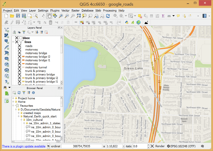
QGIS
QGIS is a free and open-source GIS software that provides an accessible alternative for spatial data analysis.
Key Features:
- Supports a wide range of file formats and databases.
- Extensive plugin ecosystem for additional functionalities.
- Active community of dedicated volunteers and organisations.
Best Suited For: Small to medium-sized businesses and individuals looking for a cost-effective GIS solution.
CARTO
CARTO specializes in spatial analysis and data visualization, offering user-friendly tools for business analysts and marketers.
Key Features:
- Drag-and-drop interface for easy data analysis.
- Templates for several use cases like market analysis, site selection, or out-of-home advertising.
- Wide range of geospatial datasets.
Best Suited For: Data scientists, developers and analysts to solve spatial problems and optimize business processes.
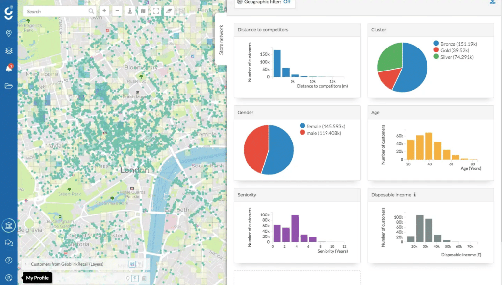
GeoBlink
GeoBlink is a Location Management Platform specially built for the retail ecosystem.
Key Features:
- Retail-focused location strategy tools.
- Integration of demographic, economic, and commercial data for location analysis.
- Visualization tools for catchment area analysis.
Best Suited For: Retail businesses and commercial real estate developers.
Mapbox
Mapbox is the go-to for developers who want to build custom, stylish maps for apps and websites, enhancing user experience with geospatial data.
Key Features:
- High customization for map design and functionality.
- Tools for integrating maps into web and mobile applications.
- Robust API support for developers.
Best Suited For: Web and mobile app developers
Choosing the Right Location Intelligence Tool
Each location-intelligence tool comes with unique features, setting them apart from each other. Before you jump in, you have to ensure that the solution you pick is the right fit for your needs. These needs may differ based on your industry, business, and the kind of data you’re seeking. Here are the boxes you need to check off before picking a location intelligence tool:
- Identify Your Needs: Determine what you need the tool for – whether it’s for advanced GIS analysis, retail location strategy, environmental monitoring, or simply for mapping and visualization.
- Consider Your Budget: Evaluate the cost against your budget. Open-source tools like QGIS offer robust features at no cost, while premium tools like ESRI ArcGIS provide advanced features at a higher price.
- Ease of Use: Consider the learning curve. Tools like Smappen are user-friendly, while others like ArcGIS require more specialized knowledge.
- Community and Support: Look for tools with strong community support or professional customer service, especially if you are new to LI.
- Trial and Experimentation: Many tools offer free trials or free plans. Use them to explore features and assess usability before making a decision.
Wrapping up
The landscape of location intelligence tools is wide. From the comprehensive and complex capabilities of ArcGIS to the user-friendly and interactive nature of Smappen, there’s a tool for everyone in the exciting world of location intelligence. Whether you’re crunching complex data or just starting out, staying in the know about these tools means you’re always ready to unlock the secrets of location data. Happy mapping!