TL;DR – Quick Summary
Territory mapping is the strategic process of dividing geographic areas for business purposes, such as assigning sales reps or franchise locations. By using modern tools and data, you can create smart, balanced territories that improve performance, reduce overlap, and boost customer satisfaction. This guide covers the fundamentals, including methods, best practices, and how to build a map in minutes with tools like Smappen.
Whether you’re striving to supercharge sales or foster franchise growth, territory mapping holds the key.
In this article, we’ll explore the essence of territory mapping and its dual role in sales and franchising. Dive into sales-territory mapping, where reps reign supreme in designated zones, ensuring targeted engagement and amplified sales. Equally vital is franchise-territory mapping, enabling equitable expansion while safeguarding brand integrity.
Discover the methods behind crafting strategic maps – isochrones, isodistances, and official boundaries. Join us in mastering territory mapping for a smarter approach to business growth.
What is Territory Mapping?
Territory mapping is the process of defining and visualizing geographic zones assigned to specific teams or individuals—typically in sales, franchising, or service delivery. Whether you’re managing customer outreach or expanding a franchise network, mapping territories helps ensure equal opportunity, efficient coverage, and stronger results.
This approach isn’t just for large enterprises. Small and mid-sized businesses use it to increase productivity, boost revenue, and create accountability across regions.
Why Territory Mapping Matters in Sales
In sales territory mapping, you assign reps to defined areas to focus their efforts and optimize results. Done right, this reduces overlap, increases lead engagement, and helps your team cover more ground with less wasted effort.
This mapping is absolutely crucial for sales leaders that need to optimize their sales resources while ensuring a steady flow of new deals through their pipeline.
Each territory is assigned on the basis of several factors, but the main purpose is to plot leads or customers onto a map and then allocate the corresponding territories to the appropriate salesperson. These areas can be divided up in several ways: isochrones, isodistances, or even official boundaries like zip codes.
Benefits of Sales Territory Mapping:
🎯 Target the right customers with location-specific strategies
🔁 Balance new customer acquisition with account retention
📈 Identify high-potential areas for expansion or realignment
🧭 Improve accountability and territory ownership
Benefits of Sales Territory Mapping:
Creating a sales territory map is easier than ever with the right software.
Here’s how to do it:
1. Plot Existing Customers or Prospects
Start with your CRM or sales data. Visualize your current customers, leads, or sales volume on a map.
2. Choose Territory Boundaries
Define boundaries based on ZIP codes, isochrones (drive-time areas), or city limits. Choose what makes the most sense for your sales structure.
3. Segment by Volume and Potential
Group leads or customers based on size, type, or potential value to ensure equitable distribution among reps.
4. Draw Territories Using Mapping Tools
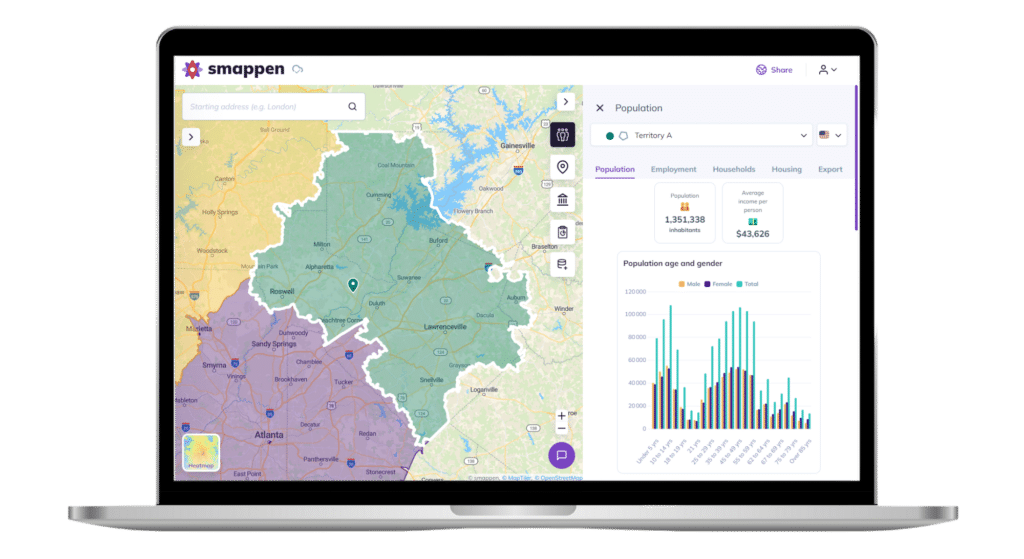
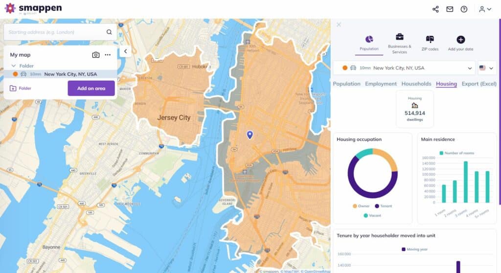
Use tools like Smappen to draw, color, and label each zone. These tools also allow you to pull in census data and market intelligence.
5. Reassess and Adjust Periodically
Territories aren’t static. As your business grows, revisit your maps to reflect real-time performance, market shifts, and team changes.
What is franchise territory mapping?
Franchise territory mapping ensures that each franchisee has a well-defined and fair area to operate, reducing internal competition and protecting brand reputation.
Franchise Territory Mapping: Expansion Without Cannibalization
Why It Matters:
🛡️ Ensures territorial exclusivity for each franchisee
⚖️ Creates fairness in market opportunity
📊 Allows data-driven decisions for expansion
🧠 Helps avoid overlap and internal competition
Franchise Mapping Checklist:
Map existing franchisee coverage
Analyze local market demographics
Compare territories based on revenue potential
Reference competitor territory models
Use zoning studies to determine prime expansion areas
With tools like Smappen, you can access built-in demographic data, import your franchisee list, and easily visualize open market opportunities.
Growing a franchise can be extremely exciting, but that growth needs to match an overall strategy. Otherwise, you risk unintentionally cannibalizing your own business.
Map out coverage areas for existing franchisees
Before you can carve out territories for new franchisees, you have to know what kind of coverage you already have. Using a location-intelligence tool like Smappen is a great way to map coverage areas using your own customer data, isochrone maps, or built-in demographic data.
Review the performance of existing franchisees
By tracking sales data for existing franchisees, you can get a sense of how existing territories are performing. Using this as a baseline, you can then map out territories you haven’t been able to break into yet while getting a sense of the size of territory a single franchisee can realistically handle.
Study the competition
Some of the largest companies in the world are franchises, meaning there’s a lot of data available on successfully mapping out franchise territories. Look at businesses in your industry, study how they create their territories, and see what works for your business.
Territory Mapping Methods: Isochrones, Isodistances, and Boundaries
The way you define your territories matters. Here are the three most common techniques:
Isochrones: Areas based on driving time (e.g. 15-minute zone). Best for understanding real-world access to locations.
Isodistances: Simple radius zones (e.g. 10 miles from a store). Quick but less precise.
Official Boundaries: ZIP codes, cities, counties. Good for reporting and CRM alignment.
Smappen allows you to use all three methods—plus manual drawing—so you can pick what suits your use case best. Start creating a territory map
How do you create a sales territory map?
To create your sales-territory map, you need to know which criteria you will use for drawing the areas. The most common method is to plot your customers or prospects on a map using data from your CRM or sales tool. From there, you can estimate the volume each territory can realistically handle and draw areas that fit more closely with your data.
With a tool like Smappen, you can do this all on one platform. Just import data from your CRM or a spreadsheet and you’ll get an instant visual representation of where your customers are. Then, you can draw an isochrone map in just a few clicks to get your first sales territory.
Don’t have this data handy? Just use Smappen’s built-in data — including U.S. Census data — to get an approximation of the addressable market for a specific area and use that top draw your sales territories.
Recommended Territory Mapping Tools
You don’t need GIS expertise to build detailed, data-driven maps. These tools help streamline the process:
Smappen
Smappen is an online tool that allows you to create unlimited custom maps, on which you can isochrone maps, isodistance maps, and more.
Intuitive online platform with unlimited custom maps
Create drive-time (isochrone) or radius (isodistance) areas
Import CRM or spreadsheet data for real-time insights
Access US Census and demographic overlays
Use color-coded layers to compare performance
With Smappen, you can draw up to 10 areas for free. After that, you will need to take out a monthly subscription to access the other features.. You can use Smappen for both franchise mapping and sales mapping. It also has lots of other uses, such as sales performance analysis, marketing campaigns, or market research.
Spotio
Spotio is specifically designed for sales. You can customize your map with territories and map your customers. It has more sales features, like task automation and sales routing. Spotio can be linked directly to your CRM software. However, it doesn’t offer additional data on demographics or anything else. So, to use it, you need to have your own database. There is a monthly subscription for using Spotio.
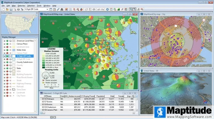
Maptitude
Maptitude is a geographic information system (GIS) tool. It is very comprehensive and made for many different use cases. You might need some training, as it is harder to get to grips with than the other two tools mentioned above. You can add as many country-data packages to the tool as you need. There is an annual subscription.
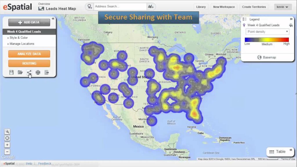
eSpatial
eSpatial is territory-mapping software made for both sales and franchising. You can import your data, customize your maps, draw boundaries for your territories, and plan routes. There is an annual subscription, starting at $1,295 year.
Frequently Asked Questions (FAQs)
Franchise territory mapping ensures fair and exclusive market areas for franchisees, reducing internal competition and supporting strategic expansion based on population, income, and demand data.
Use isochrones or free-draw options in tools like Smappen to build custom territories based on real travel times or other criteria.
Yes. Use built-in demographic data to estimate potential and draw territories even before launching in a region.
Tools like Smappen, Maptive, and Mapline offer easy-to-use interfaces and powerful features like drive-time zones, ZIP code overlays, and demographic filters. Smappen stands out for its simplicity and no-code setup.
Yes! Advanced territory mapping software like Smappen lets you use isochrones (drive-time areas) to build realistic territories based on actual travel time from a central point.
Yes, Smappen allows you to export your custom territory maps or share them with colleagues through links or embedded dashboards.