
- Founded in 2004
- Two flagship stores and two outlet stores in Tennessee and Mississippi
The Great American Home Store is a locally-owned furniture store concentrated in Memphis, Tennessee. It has the largest selection of in-stock home furnishings in the Mid-South area, meaning its customers can get a great in-store experience and pick up their furniture, all in the same day.
Justin Bowen
Ecommerce Manager
Justin first joined The Great American Home Store as a Digital Manager back in 2014, and has held the role of Ecommerce Manager since 2021.
His mission:
- Growing The Great American Home Store’s online presence.
- Overseeing digital marketing efforts.
- Evaluating and rolling out software across the business.
- Managing the store’s website and online sales.
- Running a range of other digital initiatives.
The challenge
Geography is one of the greatest challenges of running a successful furniture store in the Mid-South. Memphis, Tennessee — where two of The Great American Home Store’s locations are — is one of the largest metropolitan areas in the region. But scattered around it are smaller municipalities and rural areas that are an important logistical consideration for stores operating in the region. Before using Smappen, Justin used clunky manual methods to account for this and calculate accurate delivery costs for each location.
“I was using the Google Maps API and Google Sheets to call the driving distance and calculate it off of a location. And then I needed to figure out our delivery prices. It was very time-consuming; it would take me a whole day or two every time I had to reprice or rebuild my list.”
The solution
Generating driving distance maps
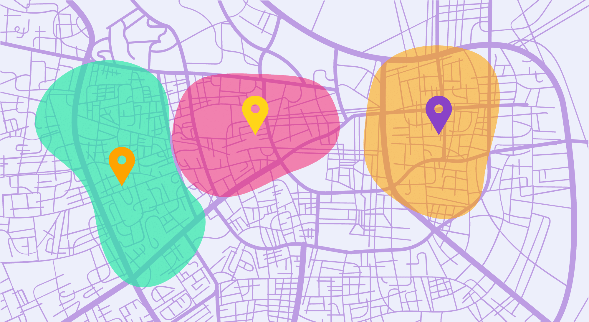
With Smappen, Justin can quickly create a driving radius map for any of his locations that takes actual driving conditions into account. “As the crow flies” maps are great for some purposes, but they’re not very helpful for delivery drivers who have to deal with geographical obstacles.
“With Smappen, I could say ‘Here’s my point of origin, here’s the distance I want to drive, generate the list, export the list.’ I have what I need right away, and it’s been very easy.”
Seamless market research
The Great American Home Store is a growing business, and to support that growth, they’ll need more distribution centers. But in an area like the Mid-South, you can’t just pick the cheapest location and sign a lease. You need to find a place that can help you support rural customers as well as those that shop and live in Memphis. That’s why Justin uses Smappen to do this kind of research.
“Smappen lets us simulate different delivery areas and see if we could, say, expand our delivery radius to 500 miles around a point of origin. That lets us know which markets we could reach into, helping us with our planning and strategizing.”
More effective sales reporting
Businesses with multiple locations need to compare performance metrics across their stores. This doesn’t just allow business leaders to tailor their sales strategy, but it’s also useful for marketing efforts later. While this can often involve a whole suite of tools, Justin uses Smappen to serve many of these functions.
“I use marketing information like customer lifetime value, population average sale, and revenue per population, and I’ll layer it with maps in Smappen. It helps me understand the geography much better so that I can optimize my marketing and advertising spend.”
The results
- Working with custom imported data.
- Quickly generating driving distance maps.
- Contributing to sales reporting and marketing strategy.
- Being at a price point where it can augment other tools.
- Saving tons of manual work by replacing clunky processes.
- A benefit or feature of using Smappen
“Tools like Smappen are extremely helpful for knowing our geographies very well and it’s helped me avoid wasting ad money.”
Smappen according to The Great American Home Store
Smappen helps you create visual representations of the geographies you need to understand better. You can evaluate driving distances, represent key areas, analyze a market, or establish your service area.
Justin Bowen
Ecommerce manager at The Great American Home Store